
Madeira Travel Photography Guide
Sunrise at Ponta De Sao Lourenco
Madeira is a beautiful small volcanic island, somewhat reminiscent of Hawaii, off the coast of Africa. It is a territory of Portugal and due to its proximity to the equator and trade winds has a very mild climate and rarely gets cold. It has only recently risen in popularity with landscape photographers so there are plenty of opportunities for new compositions and locations. Some iconic features are the steep cliffs that go straight into the sea, sea stacks similar to those found in Iceland, and hiking trails above the clouds in Pico Do Arieiro. This guide will cover logistics and location advice for photographers visiting this picturesque island.
Logistics
Madeira Map
Getting There
There are no direct flights to Madeira so your best course of action is to fly to Lisbon, the capital of Portugal, and from there take a 2 hour flight to the capital of Madeira, Funchal. Funchal is the largest city on the island and the only real city as the other population centers you will encounter are really just small and slightly larger towns. Funchal is one of my recommendations of where to base out of as you are visiting locations in the southern and south eastern part of the island. The second largest town is Porto Moniz in the north west which makes for another good place to base out of as you visit locations on the northern coast. Geographically the island is more wet and green in the northern region and drier in the southern region. You will encounter almost entirely different landscapes in each.
Where to Stay
In Madeira there are options for every budget but because the exchange rate is so favorable I would recommend staying in an Airbnb rather than a hostel as I usually do. There are hotels and other higher budget options of course. Depending on the season the Airbnbs start around $20-25.
Airbnbs in Funchal
Funchal
Getting Around
If you’re familiar with driving in Europe Madeira will be very similar to that with small narrow roads curving in every which way, roundabouts, and tiny cars which are mostly stick shift. In addition to all this Madeira is a very mountainous island and the roads will be awkwardly steep so proficiency in driving stick is recommended. I believe there might be automatic cars available for rent but most likely at a higher tier. One thing I noticed that I have to mention is that the locals have a habit of always being in a rush and tailgating you. It can be especially frustrating when you don’t know the way and are using GPS going the speed limit but no matter what there was always someone tailgating me in an extreme hurry to get to where they are going. Additionally when using GPS I should mention that because this is such a mountainous island there are many tunnels and something that happened quite often is that I would be navigating using the GPS and I would lose reception going through a tunnel. Coming out the other side I will have still not regained reception and miss my exit. This actually happened quite often until I started to become familiar with the area.
Eating
As mentioned before the exchange rate in Madeira is very favorable and while I usually go the route of cooking my own food to avoid eating out there are plenty of cheap options. One popular snack is a steak sandwich using a type of round bread that can be purchased for $7-10. Even fancy meals at restaurants were very cheap as on our last night there we had a full meal of steak and fish with all the sides for a total of $50. The only thing to keep in mind is that, as is typical in Europe, restaurants open late and close early so after a long hike it’s easy to be caught off guard and have nowhere to go eat.
Typical Steak Sandwich
Locations
Sunset from Ponta Do Rosto
Sunset from Ponta De Sao Lourenco
Ponta De Sao Lourenco Map
Ponta De Sao Lourenco/Ponta Do Rosto
This was one of my favorite locations and is a mere 30 minutes from Funchal on easternmost point of the island. Ponta De Sao Lourenco is the driest region where you’ll find no trees and a desert-like appearance. There are multiple trails and viewpoints from steep cliffs overlooking the coastline both to the east and west which makes it a good spot for sunrise and sunset. Ponta Do Rosto is on the north part of the same peninsula and has more west facing views and a few trails as well. It can be quite windy here but makes a good location for flying drones especially the FPV drones which I have recently gotten into.
Sunrise at Ponta De Sao Lourenco
Sunrise at Ponta De Sao Lourenco
Cristo Rei Viewpoint
I didn’t actually get to visit this viewpoint but I saw it several times from the boat when I went scuba diving. It’s a large statue reminiscent of Christ the Redeemer in Rio de Janeiro about 20 minutes from Funchal. Due to its location on the south it faces both east and west and so can be photographed at sunrise or sunset.
Cristo Rei Map
Sunset at Pico Do Arieiro
Sunset at Pico Do Arieiro
Pico Do Arieiro Map
Pico Do Arieiro
Another one of my favorite locations in Madeira is Pico Do Arieiro. This is a 30 minute drive from Funchal that will take you above the clouds and is probably the most popular spot that will come up in Google searches for Madeira. Depending on where you are shooting from this makes for a great sunrise or sunset location. If you walk to the antenna tower east of the parking lot you will find the lookout that faces the sunrise though your experience will vary depending on the altitude of the clouds. When I visited for sunrise the clouds were pretty much blasting right into me and I had to keep wiping the camera gear. The sun eventually rose but since I was in the cloud layer I never really got a good view. Another thing to keep in mind is that even in the summer when the island is hot because of the elevation it can get quite cold up here especially in the morning where it dropped to about 40 degrees Fahrenheit. For sunset I shot from the parking lot facing west and a telephoto lens was useful in picking out peaks as the lighting hit different parts of the scene. This area is also an epic drone flying location you just have to be careful with the occasional strong winds. There is a restaurant and gift shop here too.
Sunrise at Pico Do Arieiro
Sunrise at Pico Do Arieiro
Pico Ruivo
A different part of the same mountain range is Pico Ruivo. The hike to Pico Ruivo can be done from Pico Do Arieiro which takes about 6 hours total (3.18 miles each way) and is probably the most grueling hike I have done so far. You start at the highest altitude and work your way down to a valley and series of caves before the elevation begins to gain and you’re back up at the peak. Then you do the same thing coming back. I made this hike in an attempt to shoot the milky way but it was only after the valley portion that I had a clear view and no light pollution so I would not recommend this course of action. Instead there is a shorter hike to Pico Ruivo which begins from the Achada do Teixeira parking lot which is 1 hour from Funchal since you have to go around the island. The hike from here is dramatically shorter at 1.2 miles. Pico Ruivo makes for a good sunset spot as well as for astrophotography.
Pico Ruivo
Milky Way from Pico Ruivo
Crane Viewpoint
This viewpoint is fairly well known and lies about 30 minutes from Funchal. There’s a small parking lot from where you can walk out onto a cliff that faces east/north east. The common shot here is facing down the coast as the sun lights up a very tall cliff in the distance. Unfortunately when I visited it was cloudy so I focused on some detail shots and drone flying. A classic selfie shot here is to set your camera up on the main cliff and walk down to a second outcropping that juts out so you can use yourself for perspective.
Rocks along the Coast of Crane Viewpoint
Levadas
An iconic feature of Madeira are a type of aqueducts that run from the mountains into the towns called “levadas”. Many hikes on the island will be along these aqueducts and therefore are named “Levada de…” after the area. While there are a great deal of many many levada hikes here are some that I went on and can recommend.
A levada alongside a hiking trail
Small Waterfall Along the Hike
Second Waterfall Along the Hike
Levada Do Caldeirao Verde Map
Levada Do Caldeirao Verde
This hike is about 46 minutes from Funchal and leads to a waterfall. It’s 3 miles in each direction but a very easy hike because there is no elevation gain. Being particularly popular I would recommend going early in the morning more to avoid the crowds than for the light. Along the way there are two small waterfalls that I almost enjoyed photographing more than the final waterfall because I could get them all in one shot. The final waterfall is very tall and thin and difficult to get a good composition of. There are some views along the hike out into the valley which offer good opportunities for drone shots with the ominous clouds and mountain peaks.
Close up of Second Waterfall
Main Waterfall of Caldeirao Verde
25 Fontes Waterfall
Levada Das 25 Fontes
If you’re basing out of Porto Moniz this is a convenient hike to make as it is only 30 minutes from there. This is technically two hikes with one splitting off from the main trail. Just FYI the name “25 fontes” means 25 waterfalls and is named so not because there are 25 waterfalls along the trail but because when you reach the end the waterfall is made up of one main fall and 24 other trickles. I have a feeling that in the wetter season the waterfall is of a heavier flow. The full hike is about 2 miles in each direction and begins from the parking lot where there is a paved road. A shuttle is available to take you down to the beginning of the dirt trail which only costs a few Euros but runs only during limited daytime hours. The shorter part of the hike called Levada Do Risco leads to a tall waterfall that is probably more impressive than the 25 Fontes and only takes about 15 minutes. The hike to 25 Fontes can take 2 hours and is quite long with some ups and downs but there are a few nice views along the way. The waterfall itself is a little hard to find a good composition of and the only shot I really liked was one using a fern in the foreground and the waterfall in the back.
Levada Das 25 Fontes Map
Porto Moniz Map
Porto Moniz
Porto Moniz is the second largest town on the island and it’s main tourist draw is a series of natural pools that have some foundations built around them. They’re probably nice to bathe in but as far as taking photos they didn’t look natural enough to inspire me. Could be worth a drone shot though. Because it’s about 52 minutes from Funchal I would recommend basing out of here and visiting the locations nearby.
Sunrise at Ribeira Da Janela
Ribeira Da Janela
A tiny town 10 minutes from Porto Moniz is Ribeira Da Janela. The iconic part of this town is a set of pyramid shaped sea stacks right on the beach very reminiscent of Iceland. They make for a great focal point for a sunrise shoot or for drone shots.
Ribeira Da Janela Map
Sunrise at Ribeira Da Janela
Drone Shot of Sea Stacks
Sunrise at Seixal
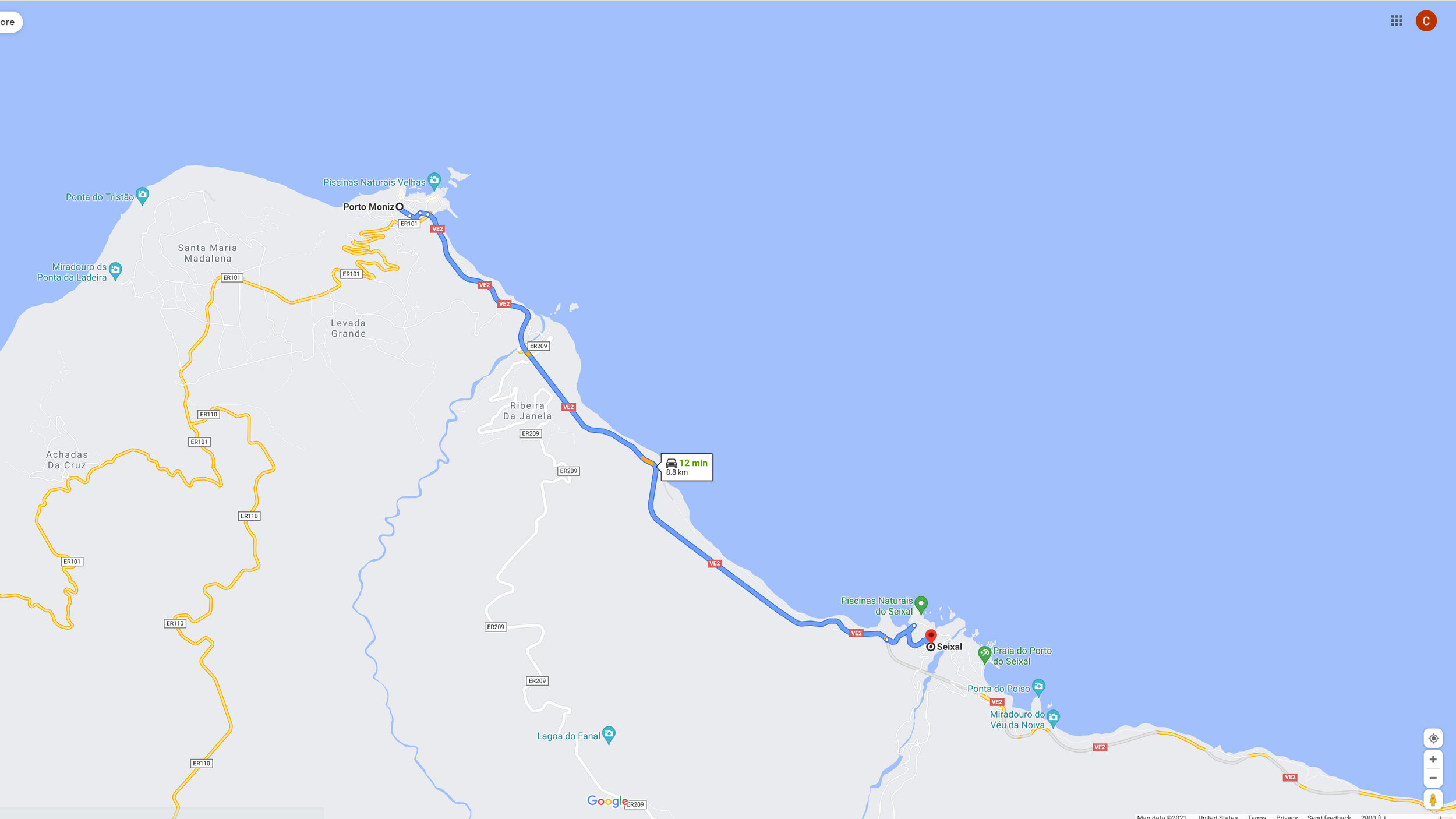
Seixal Map
Seixal
A little further down the coast from Porto Moniz is another small town called Seixal. Seixal also has some similar natural pools but more photogenic in my opinion. The rocks here are a sort of basalt looking type and you can carefully climb into the tide pool area to use the lines in the rocks and reflections as foreground elements. This is also a sunrise location as it faces east.
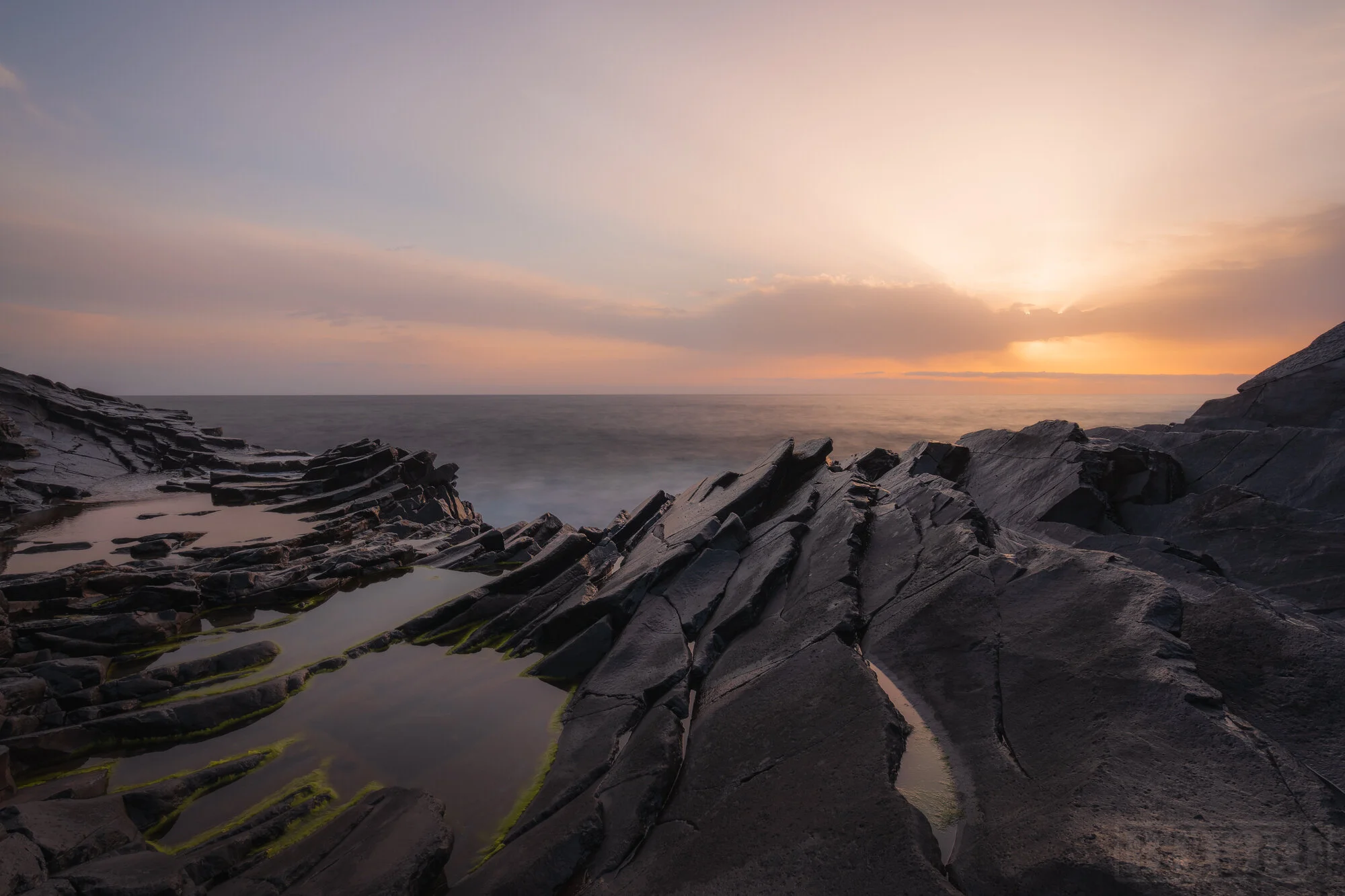
Sunrise at Seixal

Sunrise at Seixal
Bridal Veil Falls
Near Seixal is Bridal Veil Falls which is technically inaccessible but there’s a small parking lot from where it can be viewed. It can probably be photographed with a drone but I only flew my FPV drone there.
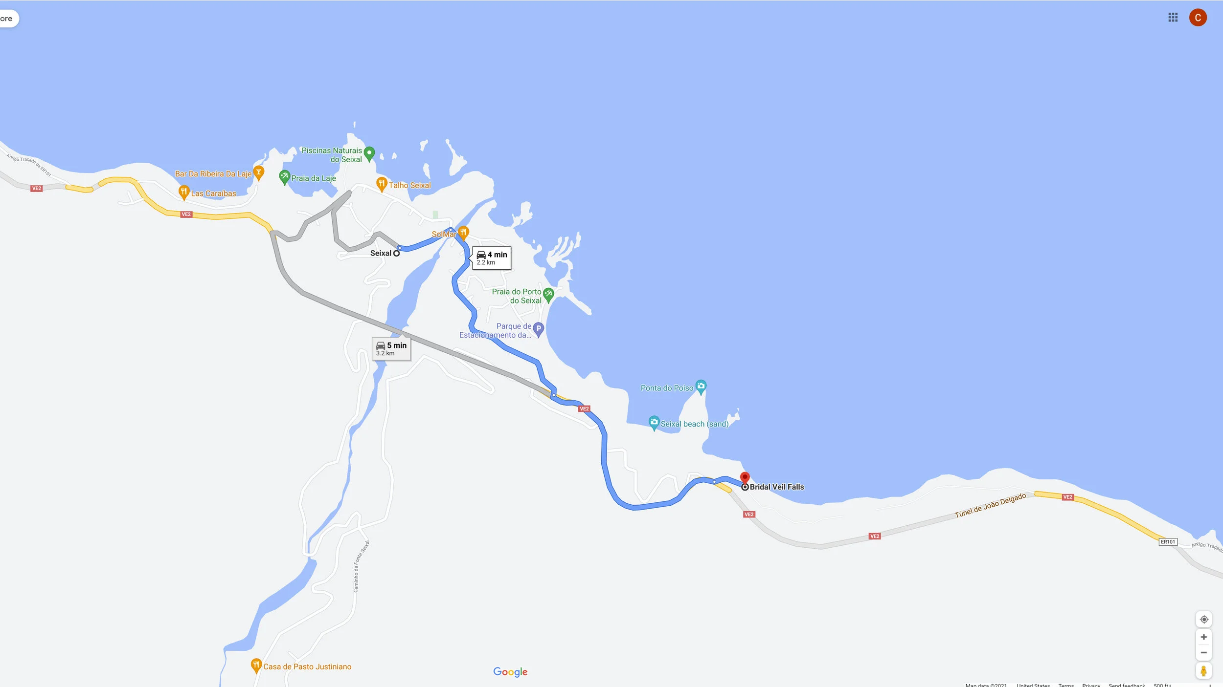
Bridal Veil Falls Map
Sunset at Fanal
Astrophotography in Fanal
Fanal Map
Fanal
My favorite location in Madeira was definitely Fanal. Fanal is a forest 20 minutes from Porto Moniz on top of a mountain. What makes this place unique is how it can go from the foggiest place you’ve ever been with no more than 20 feet of visibility on some days to absolute clear skies perfect for golden hour and astrophotography on other days. Additionally the type of trees you find in Fanal are just so unique and contorted in strange sometimes humanlike shapes. These look especially eerie in the fog. There are 2 parking lots here but you can walk to the more dense and slightly less dense part of the forest from either of them. On foggy days I would recommend dropping a google pin to find your way back to the parking lot because everything looks the same in the fog. As mentioned this spot makes for a great location for sunrise, sunset, or astrophotography depending on whether it’s foggy or not. One thing to note as far as astrophotography, there’s a strange light pollution that surrounds the horizon in all directions and it actually adds to the composition more than detracts because it almost looks like the sun just went down. It’s definitely worth multiple visits and your compositions are only limited by your creativity.
Sunset in Fanal
Sunset in Fanal
A Foggy Day in Fanal
A Foggy Day in Fanal
Astrophotography in Fanal
Sunset in Fanal
A Foggy Day in Fanal
A Foggy Day in Fanal
Sunset at Miradoura Ponta Da Ladeira
Miradoura Ponta Da Ladeira
12 minutes from Porto Moniz is a viewpoint on the west coast called Miradoura Ponta Da Ladeira. This makes for a good sunset location but shooting here is kind of tricky as it is a wide viewpoint with nothing much else going on in the foreground. You can get telephoto shots of the cliffs and maybe the water receding from the coast line but that’s about it. I also got a little creative with the drone as well.
Miradoura Ponta Da Ladeira Map
Sunset at Miradoura Ponta Da Ladeira

Sunset at Miradoura Ponta Da Ladeira
Sunset at Miradoura Das Cabanas
Miradoura Das Cabanas Map
Miradoura Das Cabanas
This is a viewpoint you’ll find along the road driving around the north coast. I had actually stumbled upon this by accident on a day after we finished a long hike and had nothing really planned for sunset. The view faces west so while there isn’t much to focus on besides the cliffs in the distance you can get creative with the lighting and rays at sunset.
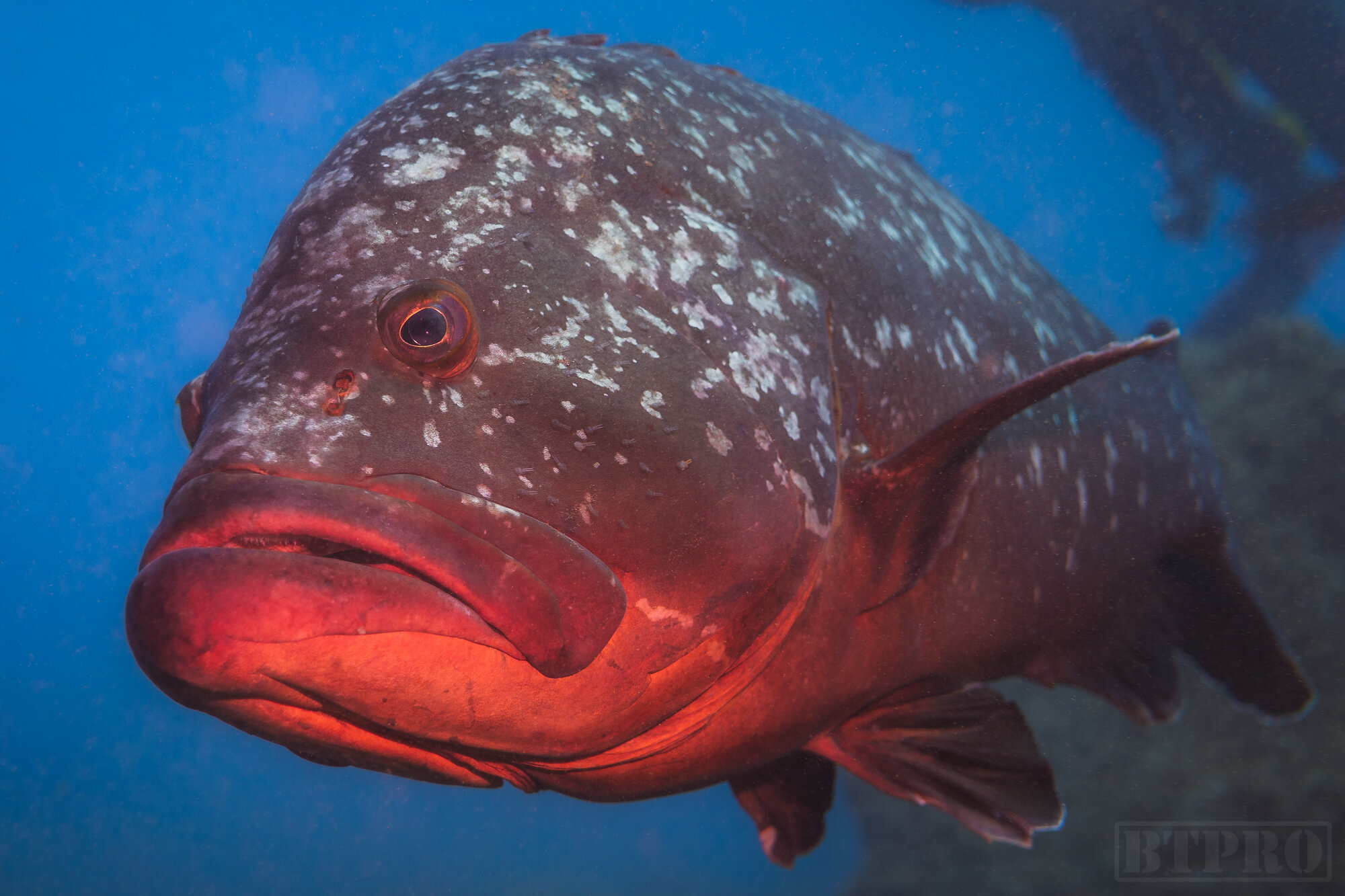
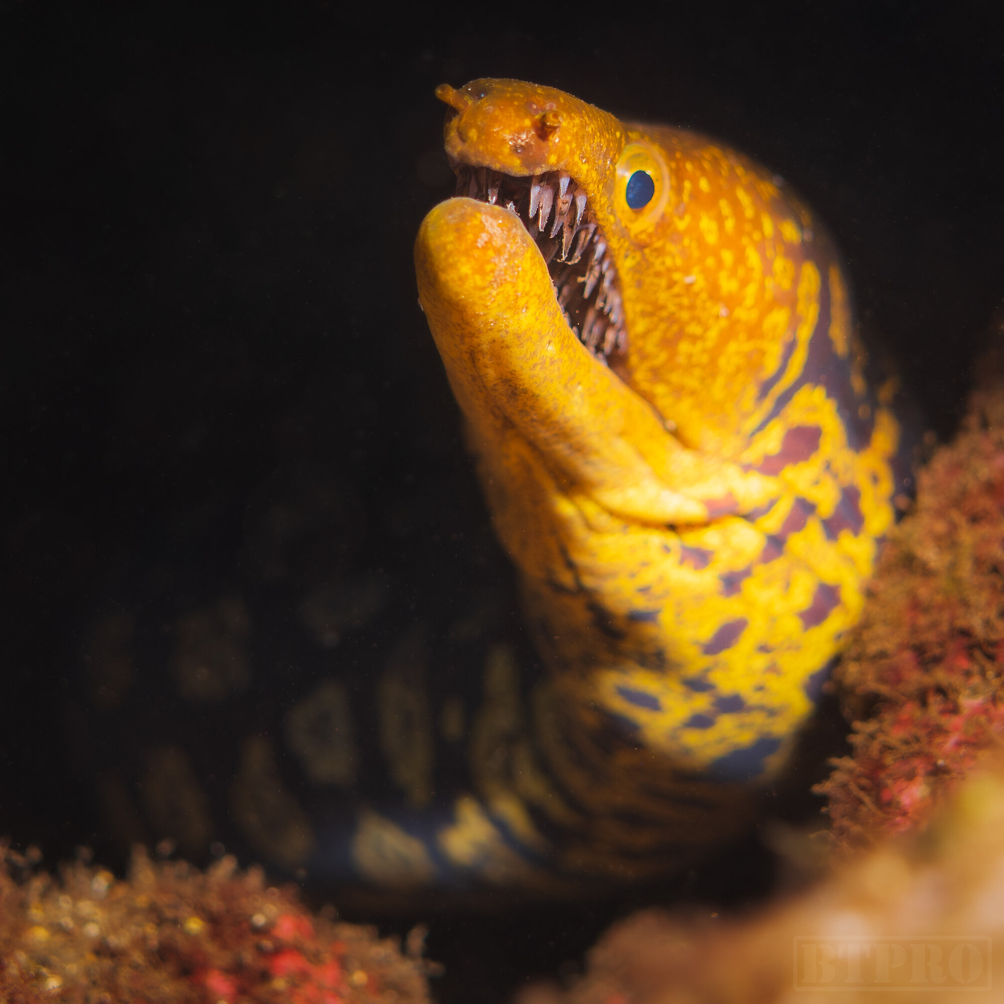
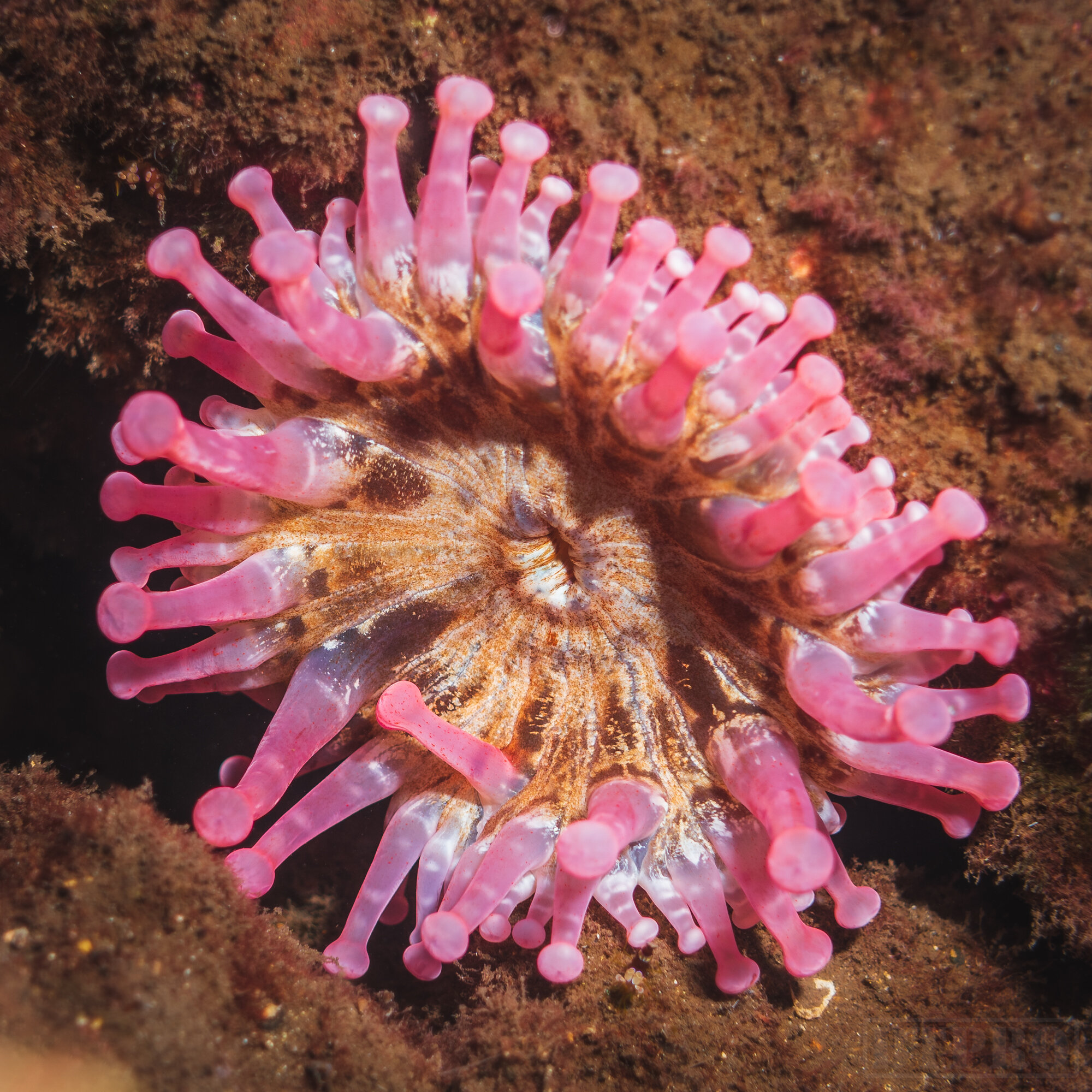
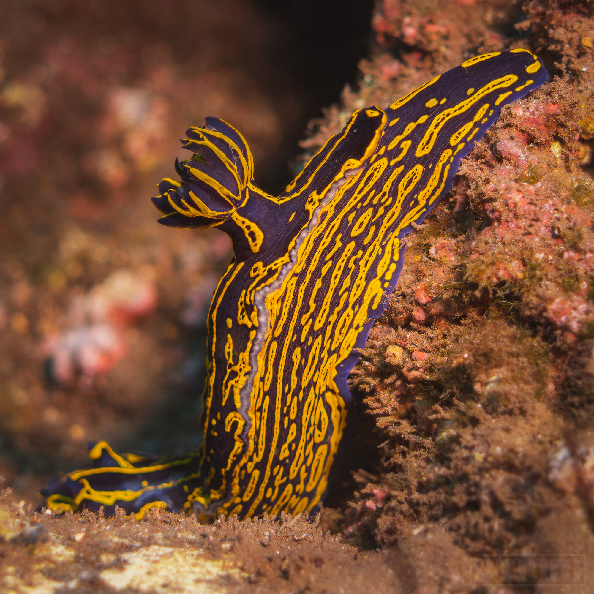
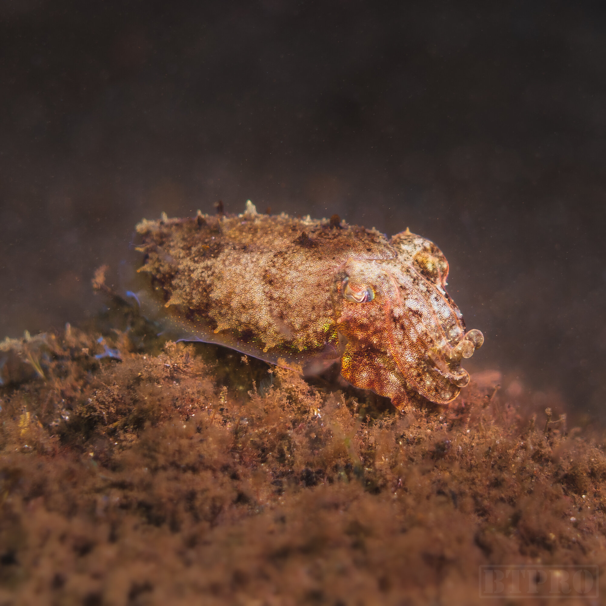
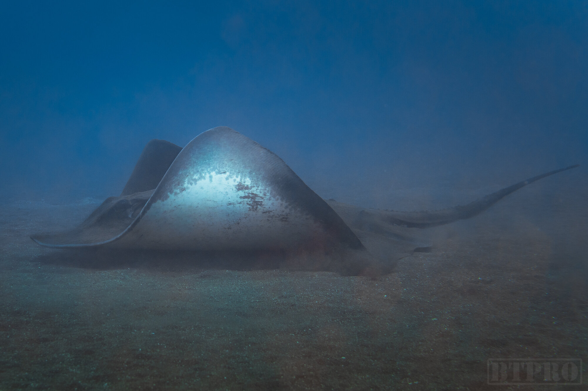
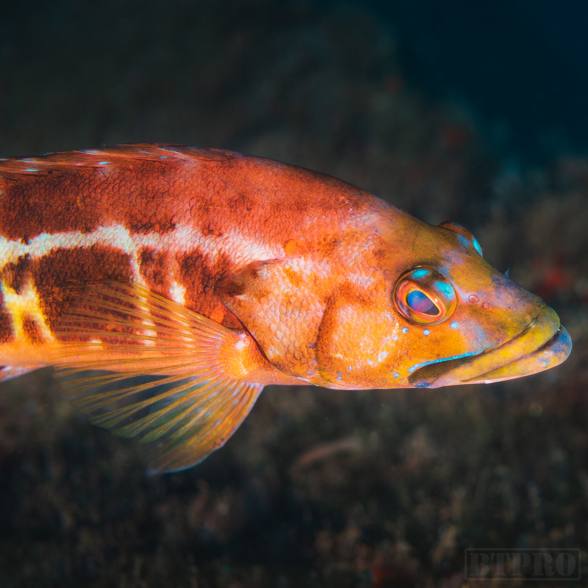
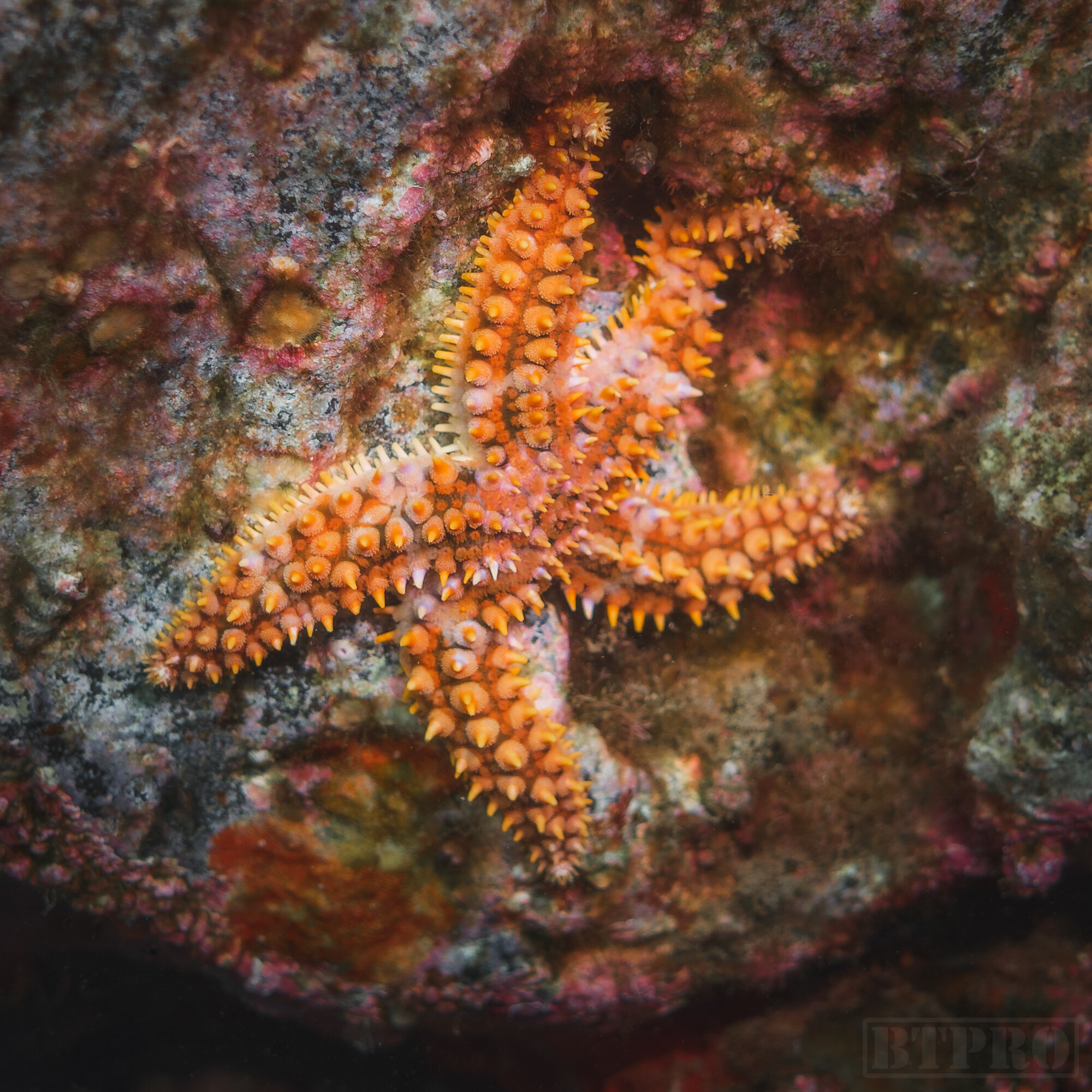
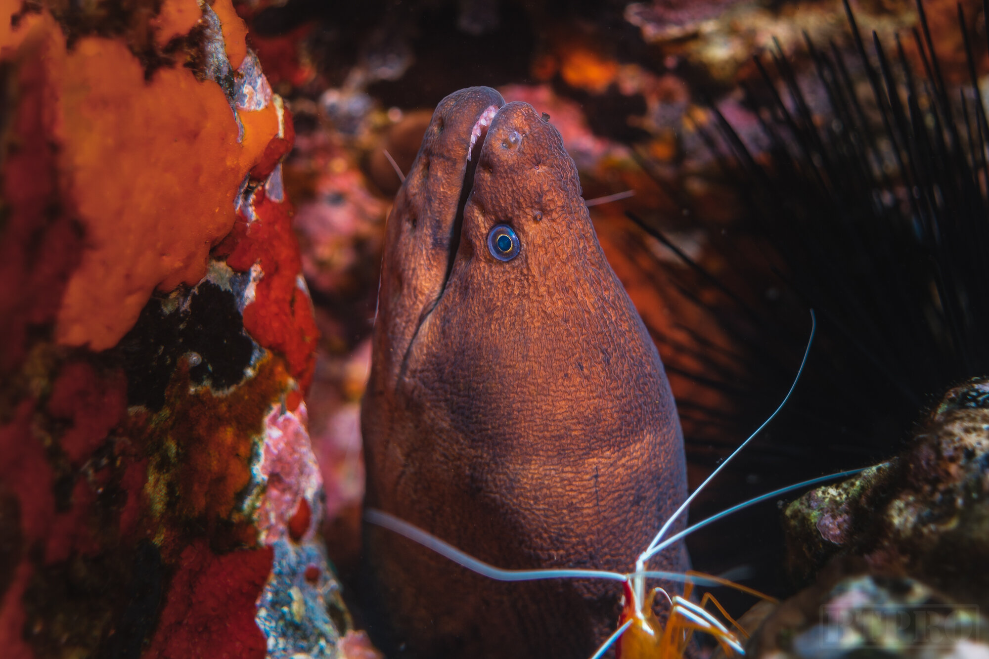
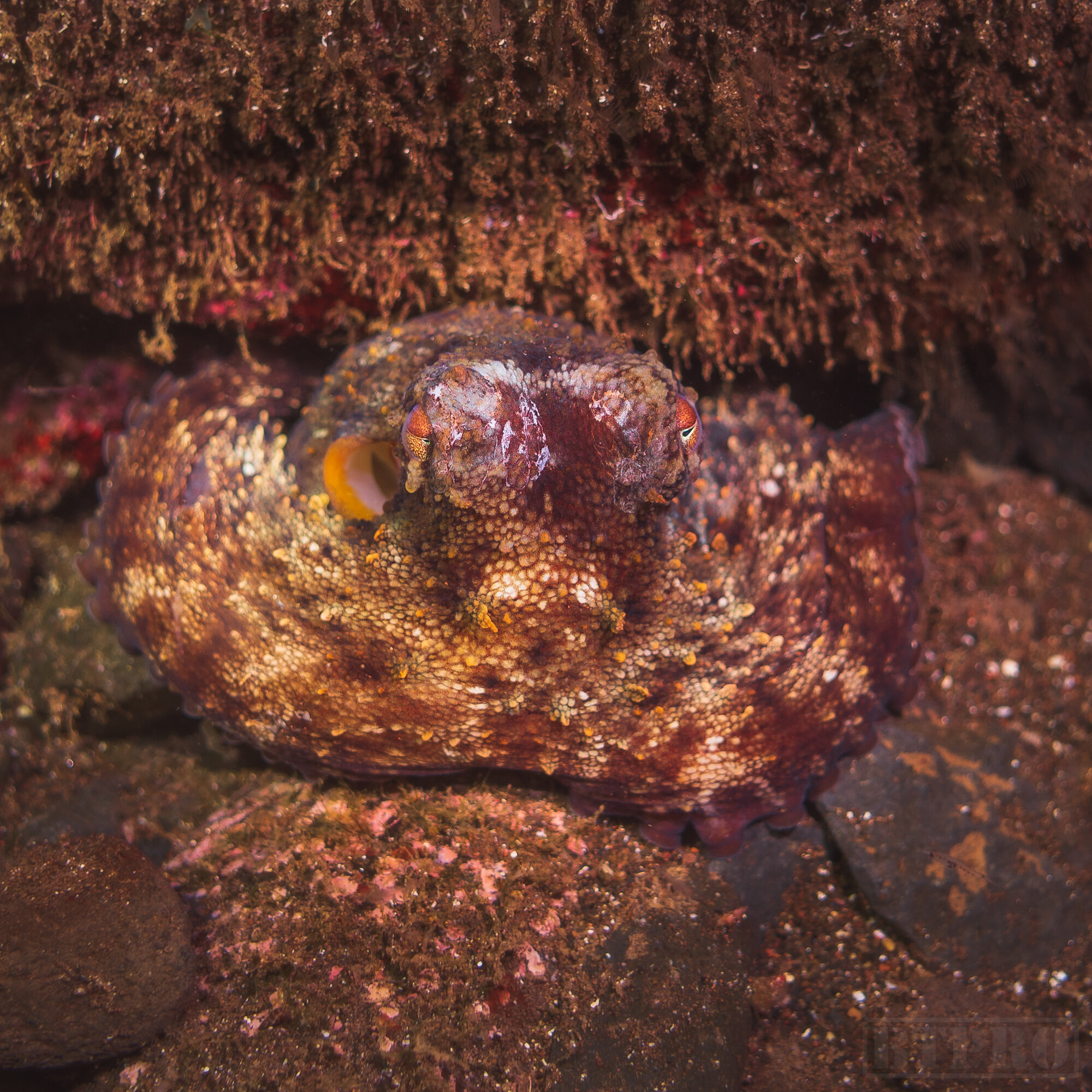
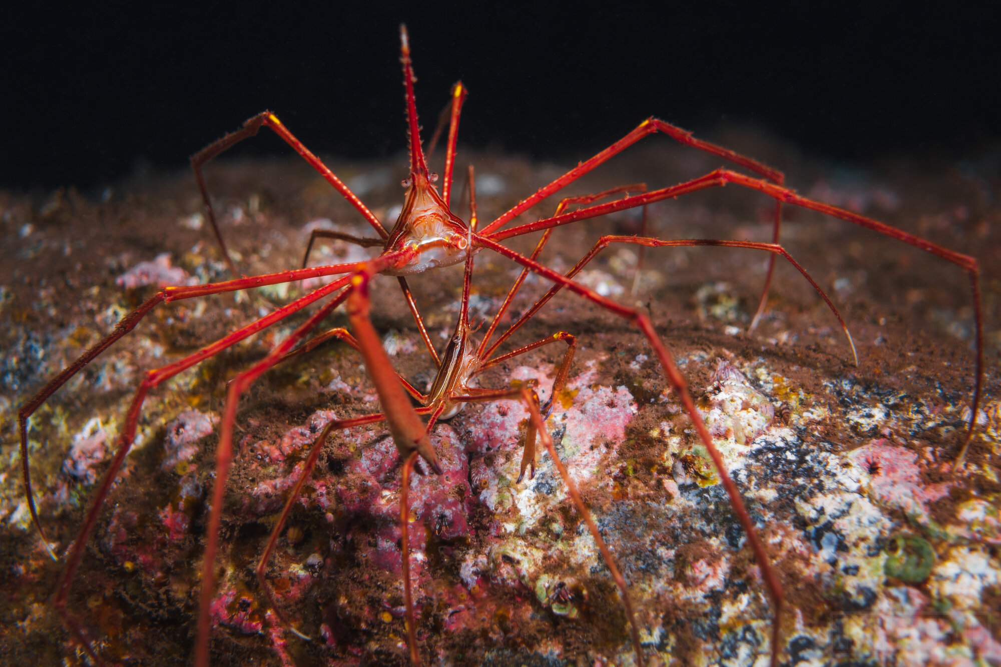
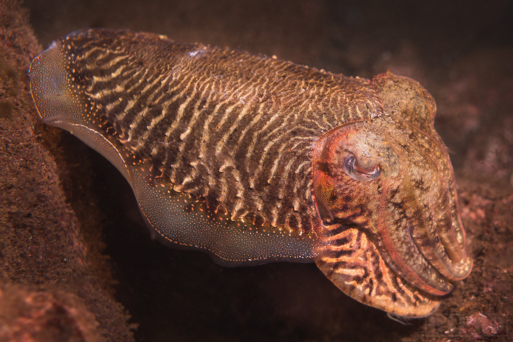
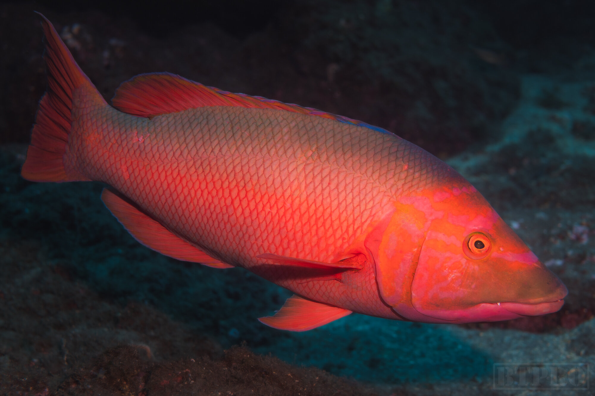
Scuba Diving
Part of the reason for my trip was to shoot a bunch of underwater photos and video for the travel film I was producing. In Madeira most of the scuba diving is done on the south coast as the water is the calmest there. Although the animal selection isn’t as diverse as a place like Hawaii you will still encounter sea life like many types of eels, giant groupers, octopus, cuttlefish, different crustaceans, giant stingrays, and of course many varieties of fish. The cost of diving was incredibly cheap and I was able to get about five dives in for much less than I would have spent in the US.
I hope this guide has been informative in planning your next trip to Madeira. There doesn’t seem to be much information out there, at least not yet, so it’s helpful to have location specifics. This is truly a magical island and you will quickly see why they call it the Hawaii of Europe with its steep epic cliffs and mountainous terrain. Below I have linked the video version of this guide as well as my behind the scenes vlog and cinematic travel film.
About
Chris Crass is a landscape photographer and travel filmmaker whose passion for creativity draws from his jetsetting lifestyle. Born in San Francisco, growing up in Dominican Republic, and now living in Miami for the last 8 years he has always sought out new experiences in far flung and exotic places and cultures. This pursuit of adventure combined with a knack for the visual arts has culminated in the founding of Boss Talk Productions and bred an artistic style that showcases locations through a flattering lens and hopefully inspires viewers to embark on their own journeys.
